DGC/CETE carries out seminar on technical project to survey data about Traditional Communities and Peoples in 2022 Census


March 22, 2022 12h33 | Last Updated: March 28, 2022 15h21
As the IBGE carries out a new census, the Coordination of Territorial Structures of the Directorate of Geosciences (CETE/DGC), together with the Supervisions of Territorial Base (SBTs) in the 27 IBGE´s State Units, elaborate on maps and statistical data to produce an up-to-date version of the mesh of enumeration areas. The mesh is one of the key elements of the census activity, since it produces the maps that will guide the enumerators in the field and help them to correctly cover their work areas. With up-to-date and good-quality maps, it is easier to find the households and their residents and, thus, apply the census questionnaires.
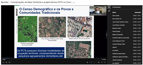
Slide presentation during meeting of DGC/CETE with the Census Coordinations of Territorial Base
In this respect, the planning of the territorial base for the 2022 Population Census has demanded additional efforts in relation to the previous censuses. The reason is that a new methodology will be introduced in this census - developed in the scope of the activities of the Workgroup of Traditional Communities and Peoples (GT of PCTs) - to survey indigenous and quilombola populations. The latter will be surveyed for the first time in a census and, together with the indigenous people, it will have specific procedures to reach all the territories where these people live. In other words, in several situations where they can be found like in rural or urban areas, in the country, in forests or in the cities.
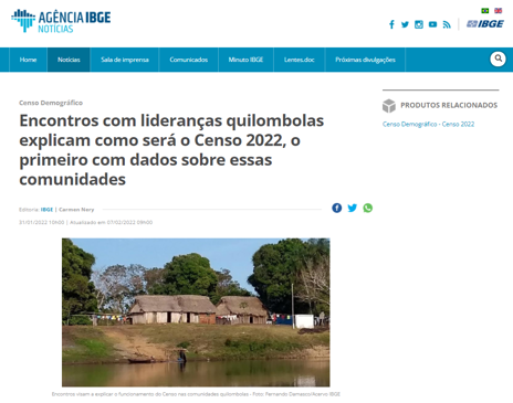
Page of the IBGE News Agency informing about meetings with quilombola leaders
All these procedures were developed in a technical project that is being put into operation in a joint work of the GT of PCTs with the State Units, having CETE and the Census Coordinations of Territorial Base in the states working in the production and systematization of geo-spatial information to subsidize the scheduled activities.
Therefore, considering the relevance and magnitude of this activity in the next census, the Department of Traditional Territories and Protected Areas of CETE/DGC organized two off-site meetings on February 21 and 22 with the Census Coordinations of Territorial Base, as well as members of the Supervisions of Territorial Base (SBTs) and of other areas of the State Units. One of them addressed the teams of the State Units of the Amazon region, due to the peculiarities, dimension and access to places where the traditional communities and peoples live, especially the indigenous ones. The two meetings aimed at reinforcing the concepts defined in the technical project, introducing new features of the Territorial Base Portal, valid sampling fractions for the PCTs areas and data collected for the BIOS, as well as at clarifying doubts.
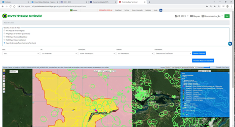
Dynamic Map of Territorial Recognition available on the Territorial Base Portal - Census
The meetings also opened the possibility that the SBT network distributed in the entire country contributes even during the data collection period. With several tools available for monitoring field activities, highlighted by the Territorial Base Portal - Census, it is possible to view the inputs for the census work in different geographic divisions, in order to subsidize the other state census coordinations.
The Territorial Base Portal - Census was developed by DI/COBAD and DGC/CETE and it will be available for servants involved in the census. This portal will provide a number of data and maps, like low-voltage consumers according to the Brazilian Electricity Regulatory Agency (ANEEL); data of oversized enumeration areas from CNEFE; estimate of occupied households; ranking of number of block-faces by enumeration area; number of enumeration areas and maps of indigenous and quilombola land and territories by municipality, area, sub-area and data collection station, as well as access to statistical municipal and urban maps (MMEs and MUEs). All the information will help to assess the consistency of the data collected, allowing to monitor them and, whenever is the case, to adjust them in a timely manner.
In addition, new features are being developed in SIGC, which will provide a data collection dashboard in states and municipalities, in which it will be possible to view the surveys by data collection station, by indigenous land and by quilombola territory, among other spatial divisions. Based on these divisions, several reports can be produced, which will be available to several management levels, especially the CCSs. It will allow a shared and detailed follow up of the data collection work, particularly in PCT areas, which require more care.